Before launching your plane, you must have a flight plan, just like a “real” pilot. A real pilot will consult aeronautical charts (maps) and the recent weather forecast. A pilot must know how much fuel will be needed and must avoid hazards.
Let’s assume you have a plane that will fly in a 40′ diameter circle in the gym, still air. Let’s assume you have a field that has 400′ of clearance between tree lines in the direction of the wind. Let’s assume you have a plane that is capable of a two minute, 120 second flight time. The plane flies in a left circle, the center of the circle is 20′ off the left wingtip. You start your flight with your right shoulder against the upwind tree line. You want the plane to land with its flight circle against the downwind tree line. The flight will start and end with the flight circle center 20′ off the tree lines, so the center of the flight circle will travel 400″ – 20′ – 20′ = 360′. We have 120 seconds to cover that distance, so the drift rate must be less than 360’/120 seconds = 3 fps (feet per second). We happen to remember, or we work it out, that 88 fps = 60 mph, so using this ratio we can figure the maximum wind we can fly in safely is (60/88) x 3 fps = 2 mph.
There is a lot of ratio and proportion or unit conversion in aeronautical or other engineering work, so that is an important part of your lesson plan.
Conversely, if we have a wind of 3 mph = 4.4 fps, we can calculate the safe time in the air. The available drift distance divided by the wind speed will give us the allowable time in the air, 360’/4.4 fps = 81 seconds. We would not wind our motors for a 120 second flight, we would put in only enough turns for an 81 second flight.
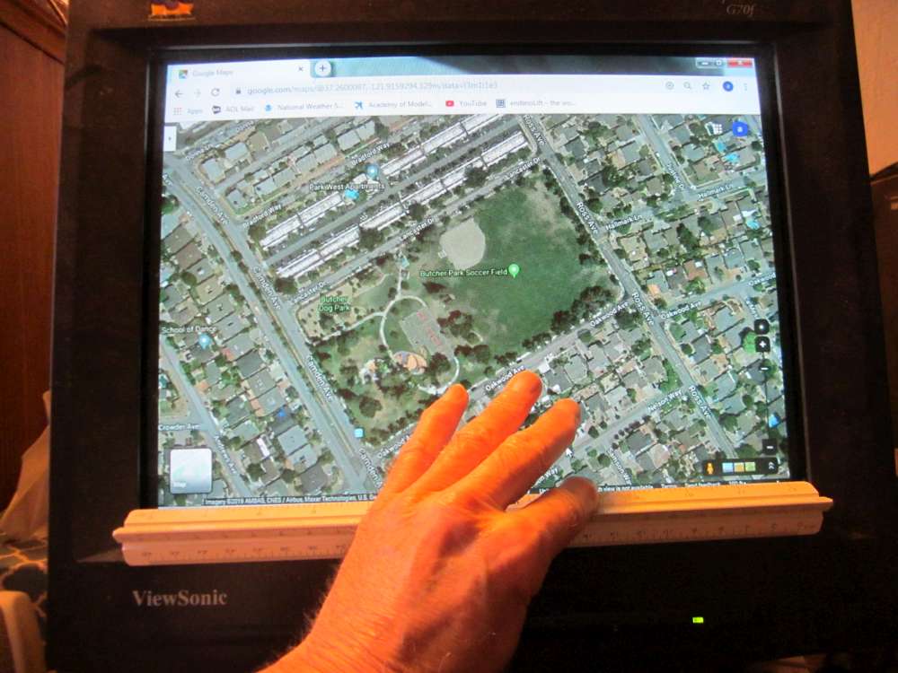
To make a flight plan, you go to Google Map and get the satellite view of your flying field. You can work on the screen or print it out. Measure the scale bar to get the map scale. With one field filling the screen, my engineer’s scale showed 0.675″ for the 100′. Go to the weather forecast to get the prevailing wind direction. Make a cardboard disk to represent your flight circle. Place it on the map and see the longest path in wind direction you can fit across your field. Measure the distance between the upwind and downwind circle centers. Now you can figure the relationship between wind speed and flight time. You can calculate several pairs and plot a graph of flight time against wind speed.
There is also the empirical approach. You gradually increase the number of turns you put into the motor until the plane starts getting dangerously close to the downwind tree line. In reality, the wind speed will gradually increase in the morning, so you are making on-field judgements all the time.
After you have flown on a field you become weather wise. You know the prevailing wind direction and you sense the wind speed on your face. I find that if there is enough wind to spin the propeller, there is too much wind to fly most of my planes, unless I move to a bigger field. It is hardly worthwhile to make flights of less than one minute. The best flight plan is subject to revision according to field conditions. You don’t need to do the map thing, but it is a good exercise to teach what must be considered in making a flight plan, and that is the purpose of a class.
For weather forecasts, go to weather.gov . You click your location on the map and go down to the forecast graph. You then check the forecast for winds of 2 mph or less before heading out to the field.
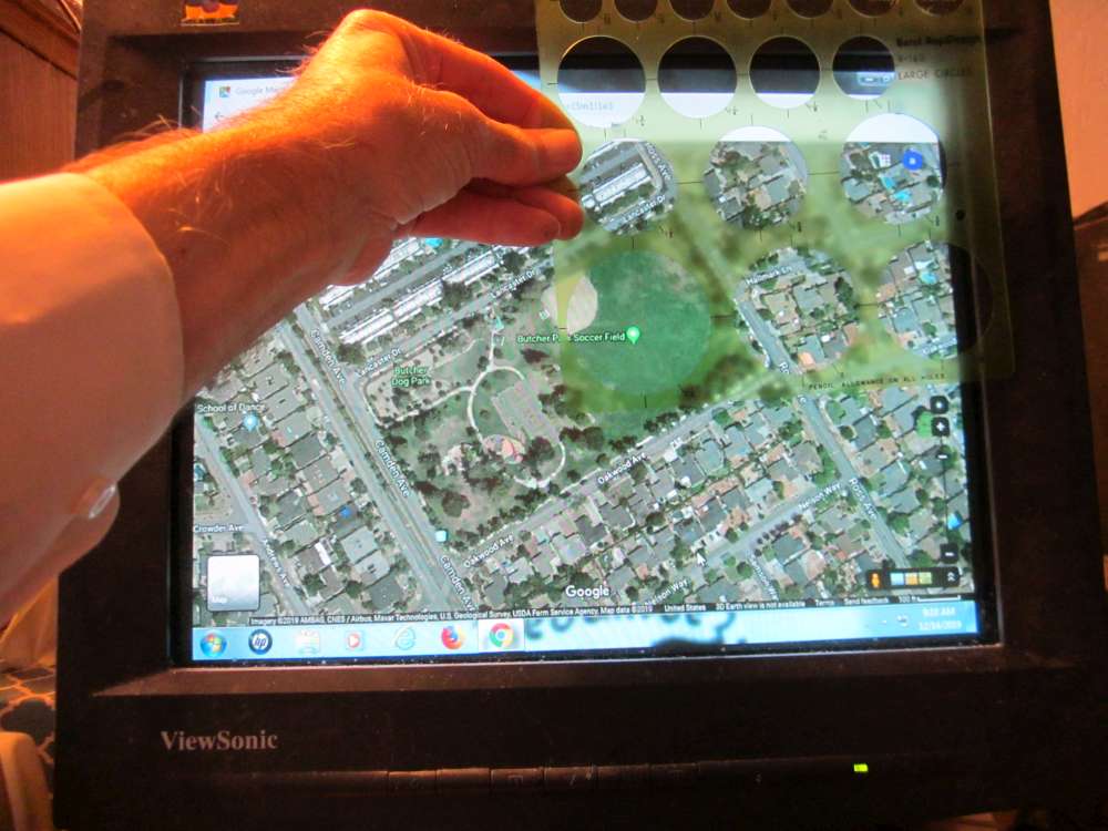
You can also use the Google Maps to search for flying fields of adequate size. I use a set of drafting circle templates to see how large a circle will fit within the open area. Here the 2 1/4″ circle fits comfortably inside the trees surrounding the lawn. This represents a circle of 2 1/4″ x 100’/0.675″ = 333.33′.
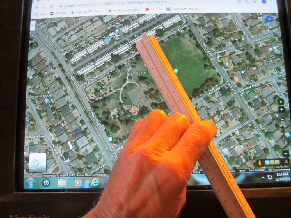
The field was a little larger than the circle. It is good to have a safety margin. If you want to know the maximum circle that will fit and you don’t have a finely graded set of circles, you can simply measure the width of the field with a ruler. This shows 3″ between the trees, with the wingtips probably brushing the leaves. The largest circle then is 3″ x 100’/0.675″ = 444.44′.